Iron ore (Fe) · PL 0119/2025

Moiyabana Iron Ore Project

675.92 km² of Banded Iron Formation targets on established road, rail and power.

PL 0119/2025

At a glance

675.92 km²

Licence area across the Mahalapye–Shoshong iron province

4 targets

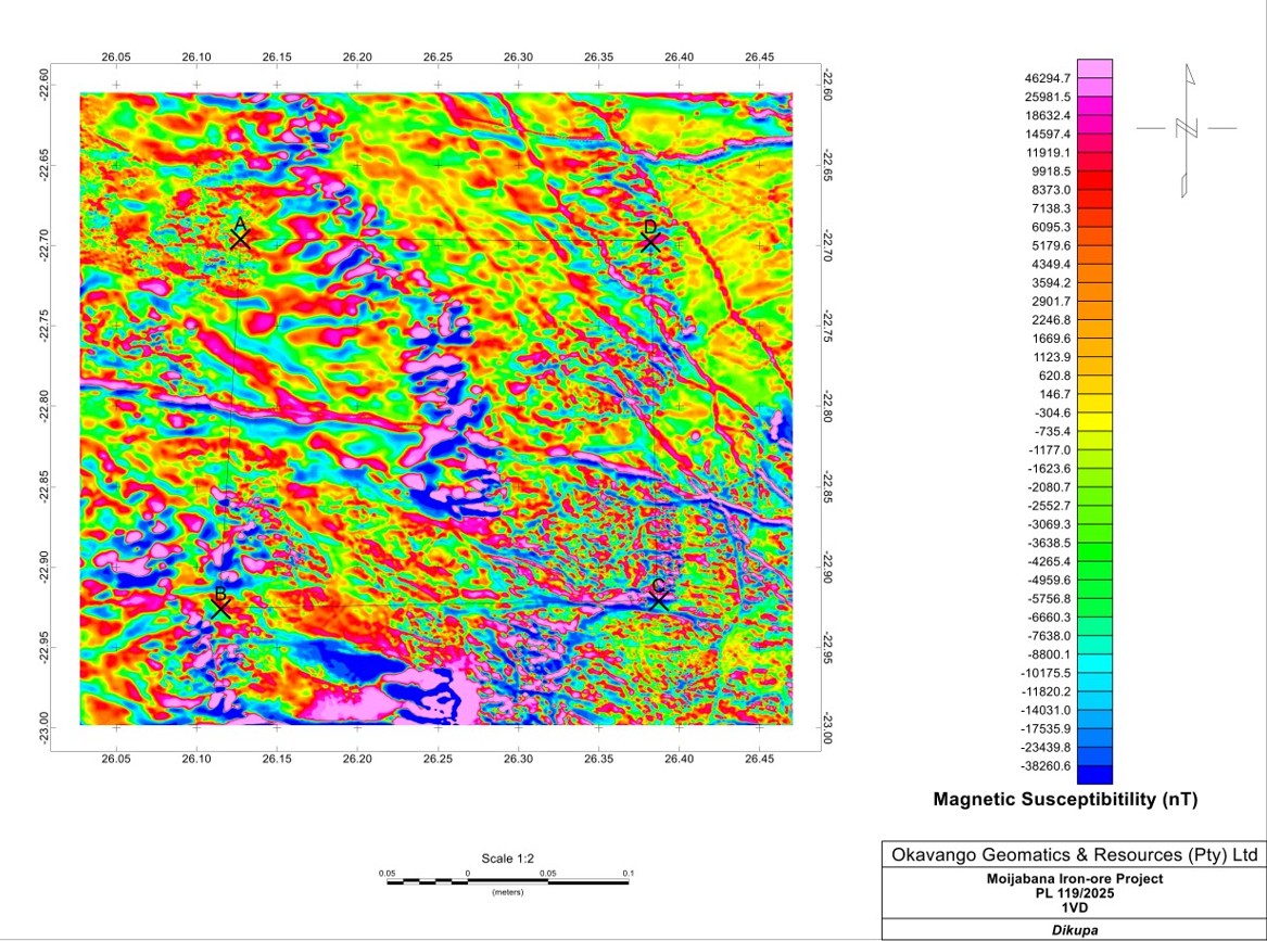
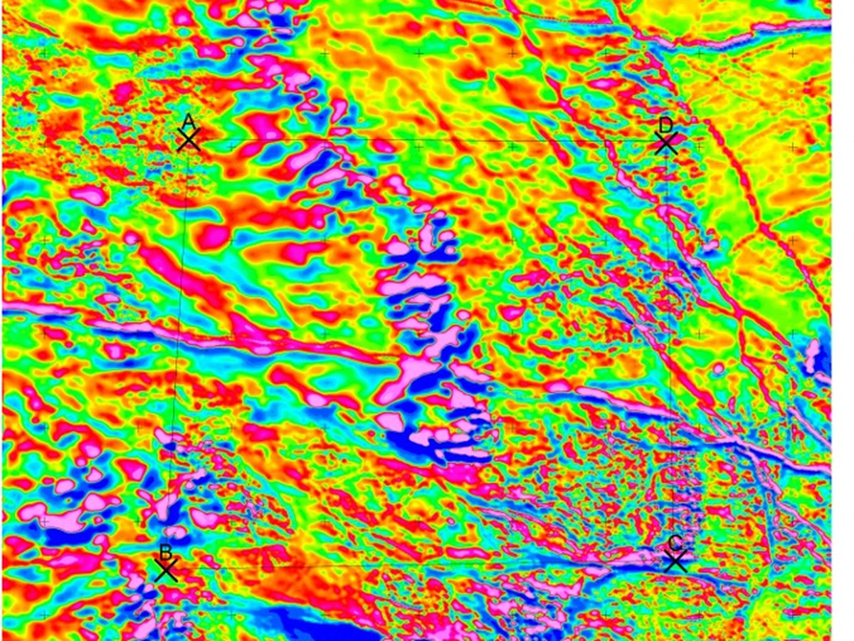
Targets A to D defined on the aeromagnetic interpretation

100%

Ownership, held with clean title

Project overview

Mahalapye–Shoshong iron province

PL 0119/2025 is a district-scale exploration opportunity in the Mahalapye–Shoshong iron province of central Botswana. The project targets banded iron formation (BIF) mineralisation interpreted to occur within iron-rich sedimentary sequences associated with the Shoshong Formation and adjacent Proterozoic successions.

Regional interpretation suggests the licence may lie within the northern extension of iron-bearing stratigraphy comparable to the Thabazimbi Iron Formation. This is a geological target to be tested rather than a proven extension, and it is what the work programme is designed to evaluate.

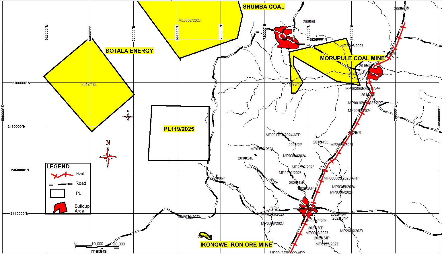
The licence sits inside an established mining and infrastructure corridor carrying coal, power generation, rail and major transport networks, which materially lowers the cost of any future development.

Licence
PL 0119/2025
Holder
Falcon Metal Resources Botswana (Pty) Ltd
Size
675.92 km²
Commodity
Iron ore (Fe)
Location
Mahalapye–Shoshong iron province, Central District
Stage
Early exploration
Ownership
100%

Geology

Why this ground

District-scale opportunity

A highly prospective iron terrain within an emerging iron province, with room for both discovery and resource growth.

Infrastructure advantage

Close to the A1 highway, Botswana Railways, national power and water, and the industrial centres of Mahalapye and Palapye.

Established mining corridor

An active mining region with coal mining, power generation and mining services already in place.

Tier-one jurisdiction

Botswana offers political stability, a transparent regulatory framework, secure mineral tenure and access to South African export ports.

Geology

Remote sensing

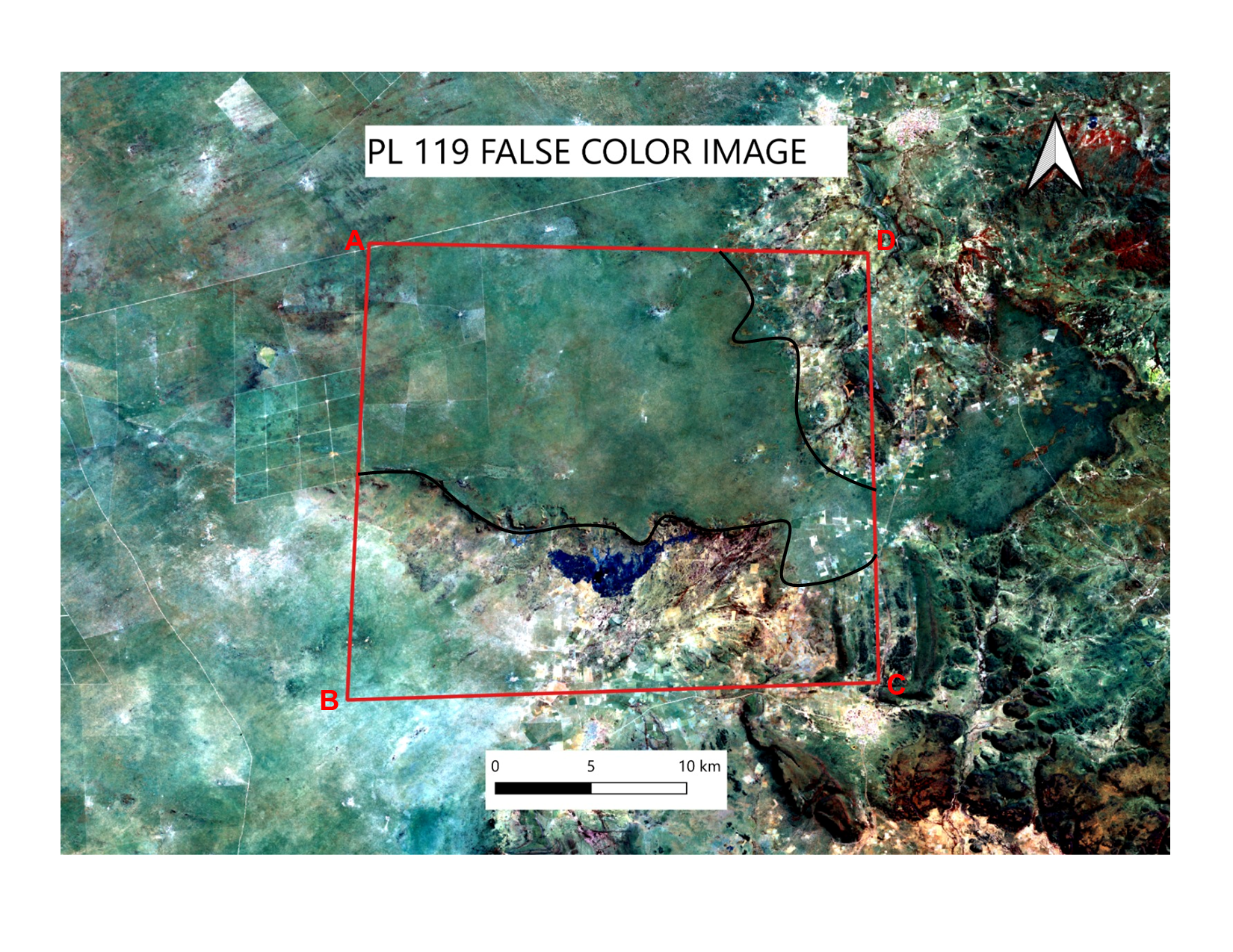
The False Colour Composite of LANDSAT data shows that 2 prominent areas within PL119/2025 are ideal for ground follow up as they represent the deformation in within the PL. Field sampling and localised geological mapping would be instrumental in determining Banded Iron Formations within the PL.

Work programme

Project timeline

  1. 2026: baseline soil sampling
  2. 2027: high-resolution magnetics and IP/resistivity surveys
  3. 2027: RC drilling
  4. 2028: resource definition and pre-feasibility
  5. 2029 to 2032: bankable feasibility, construction and early production

Geology

Indicative programme

Phase Programme Objective
1 Remote sensing, ASTER alteration mapping and data compilation Define regional targets
2 Geological mapping and structural interpretation Verify lithology and controls
3 Ground magnetic and gravity surveys Delineate BIF horizons
4 Rock-chip sampling, trenching and geochemical analyses Confirm iron mineralisation
5 Diamond drilling, 5,000 to 8,000 m Test priority targets and continuity
6 Metallurgical test work and mineralogical studies Assess ore quality and beneficiation
7 Resource definition drilling Delineate a JORC or NI 43-101 compliant resource
8 Preliminary economic assessment and pre-feasibility Establish project economics

Each phase is a decision point, so expenditure stays aligned with technical results. Costed programmes and commercial terms are available to qualified parties under NDA.

Documents

Reports and presentations

  • Moiyabana investment memorandumRequest

Investor opportunities

Discuss the Moiyabana Iron Ore opportunity with our team.

Full data packages and technical findings are available to qualified parties under NDA.